
EagleNXT
EagleNXT eBee Vision
SKU#: BN967
Ships via Standard Ground
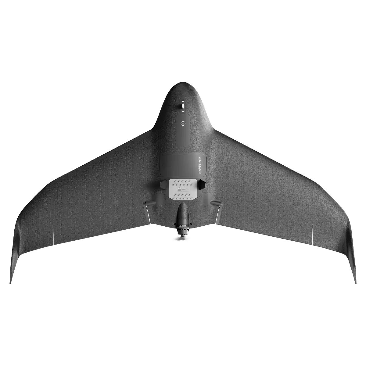
The eBee VISION ISR Drone is a Blue UAS-certified, NDAA-compliant fixed-wing UAV built for real-time surveillance, tactical reconnaissance, and public safety missions. With HD video, thermal imaging, and 32x zoom, it delivers unmatched situational awareness—even in GNSS-denied environments. Lightweight, portable, and operable by a single user, the eBee VISION is ideal for defense, border security, and infrastructure monitoring, offering secure data transmission and rapid deployment in dynamic field conditions.
Looking for a quote? Simply add your items to the cart and choose Request for Quote during checkout.
Enter a value between 1 and 100000000 in increments of 1.
Earn Darley Dollars with this purchase
The eBee VISION ISR Drone is purpose-built to meet the operational demands of government agencies, defense teams, and first responders requiring rapid, reliable, and secure aerial intelligence. With Blue UAS certification and NDAA compliance, it ensures trusted procurement and deployment within federal and state programs. Designed for tactical surveillance, border security, and emergency response, the eBee VISION delivers real-time HD video, thermal imaging, and long-range performance even in GNSS-denied environments. Its lightweight, backpack-portable design and single-operator usability make it an ideal solution for field teams needing fast, actionable insights in dynamic or disconnected conditions.
Features
- Blue UAS Certified & NDAA Compliant: Fully approved for secure U.S. DoD procurement.
- Real-time HD Video Feed: Equipped with a 32x optical zoom for detailed surveillance.
- Thermal Imaging: Enables day and night operations with infrared visibility.
- GNSS-Denied Operation: Functions effectively in GPS-contested environments.
- Extended Flight Time: Up to 90–100 minutes per mission.
- Long Wireless Range: Operates up to 12 mi (20 km) from the ground station.
- Modular Design: Quick setup and breakdown; fits in a backpack for field mobility.
- Low Acoustic Signature: Silent operation ideal for covert missions.
- User-Centric Interface: Designed with input from special forces for intuitive control.
- Multiple Flight Modes: Includes flight plan, observation, and scouting modes.
- Secure Data Transmission: Ensures safe communication in disconnected environments.
Key Benefits
- Rapid Deployment: Ready to fly in under 3 minutes by a single operator.
- High-Resolution ISR Capabilities: Equipped with HD video, thermal sensors, and 32x zoom.
- GPS-Denied Operation: Functions effectively in contested or disconnected environments.
- Single-Operator Portability: Lightweight and backpack-ready for field missions.
- Silent Operation: Low acoustic signature for stealth and covert surveillance.
- Real-Time Intelligence: Enables object detection, tracking, and geo-location on the fly.
How It’s Used
- Defense & Military: Tactical ISR missions, battlefield surveillance, and reconnaissance.
- Public Safety: Emergency response, search and rescue, and crowd monitoring.
- Infrastructure Monitoring: Surveillance of critical assets and facilities.
- Border Security: Long-range patrol and threat detection.
- Environmental Protection: Maritime and land-based monitoring.
Software & Data Workflow
- Ground Control System (GCS): High-end user interface for mission control.
- Live Streaming & Recording: Real-time HD video feed with secure storage.
- Mapping Support: Circular and grid mapping for 2D/3D post-processing.
- Secure Transmission: Encrypted data handling in disconnected environments.
- Situational Awareness Integration: Compatible with ATAK and other platforms.
Certifications & Compliance
- Blue UAS Certified
- NDAA Compliant
- Designed for Secure Procurement: Meets U.S. DoD and allied agency standards.
Use Cases
- Tactical ISR Missions
- Border Surveillance
- Disaster Response
- Infrastructure Protection
- Environmental Monitoring
- Maritime Security
Hardware and Build
- Weight: 3.3–3.5 lbs (1.5–1.6 kg)
- Wingspan: 46.4 in (118 cm)
- Design: Modular, backpack-portable, and hand-launched
- Construction: Rugged build for field durability
In the Box
- Aircraft (x1)
- Wings (x1 pair)
- Flight Battery (x3)
- Battery Charger with international adapters (x1)
- Spare Pitot Tube (x1)
- Spare Props (x2 sets)
- Screwdriver (x1)
- Radio Module (x1)
- Radio Module Battery (x1)
- Radio Battery Charger (x1)
- Radio Antenna (x1 set)
- Backpack (x1)
- Hard Transport Case (x1)
- Flight Time: Up to 90–100 minutes
- Wireless Range: Up to 12 mi (20 km)
- Weight: 3.3–3.5 lbs (1.5–1.6 kg)
- Wingspan: 46.4 in (118 cm)
- Zoom: 32x optical zoom
- Imaging: HD video and thermal sensors
- Deployment Time: Under 3 minutes
- Operating Conditions: Day/night, GNSS-denied environments
- Acoustic Signature: Low
- Model: SF540008CA